En
Log in
All resources
Create a design
Tools
11,659 Free Images of Old Map
bibliothèque nationale de france
maps from the earth and its inhabitants, vol. iv
history
historical
baroque
maps in the library of congress
piet schipperus
matthäus merian
old maps of the tyrol
engravings of topographia austriacarum
maps by alexis-hubert jaillot
old maps of the tyrol
engravings of topographia austriacarum
baroque
historical
history
maps
book
historical images of dubrovnik
baroque
robert gordon of straloch
old maps of sutherland
maps from the earth and its inhabitants, vol. iv
old maps of cardiff
géographie générale; physique, politique et économique (1876)
old maps of the pyrenees
ismailïa. a narrative of the expedition to central africa for the suppression of the slave trade (1874)
nyanza, rwanda
history
florida
maps from the mechanical curator collection available to georeference
maps from the mechanical curator collection
maps from gallica
old maps of rome
17th-century maps of savoie
old maps of savoie
17th-century maps of the netherlands
maps by pieter van der keere
voyages and travels to india, ceylon, the red sea, abyssinia, and egypt, vol. 3
henry cooper (engraver)
maps by alexis-hubert jaillot
old maps of duchy of cleves
maps from the earth and its inhabitants, vol. iv
rhins of galloway
maps from the earth and its inhabitants, vol. xvii
old maps of washington, d.c.
maps from the earth and its inhabitants, vol. iv
charts of plymouth sound
maps from the earth and its inhabitants, vol. xiii
old maps of luanda
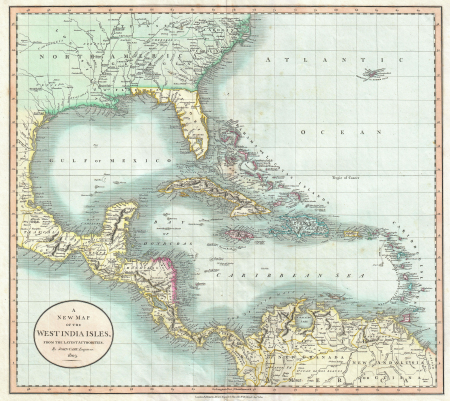
1803 maps of the caribbean
maps by john cary
south america in the 1800s
realism
tram line 112 le raincy - montfermeil
proletarian literature
beschryving van 'sgraven-hage
old maps of the hague
description de l'universe
old maps of valletta
maps from the earth and its inhabitants, vol. iv
firth of inverness
maps by willem and johannes blaeu
1635 maps
maps by john cary
1801 maps
chorographia britanniae (1741-1742)
18th-century maps of essex
historical
history
maps in the library of congress
1838 maps
old maps of łódź
kosmopolita
historical
history
maps of the islands of greece by marco boschini (1658)
old maps of the peloponnese
the british monarchy (1743)
maps in the british museum
maps by guillaume sanson
old maps of friesland
old maps of hildesheim
baroque
old maps of gdańsk
baroque
eran laor cartographic collection
johannes van den aveelen
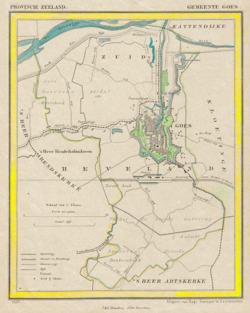
gemeente atlas van nederland - zeeland
old maps of goes
1750s maps of saxony
old maps of leipzig
atlas minor gerardi mercatoris (1609)
maps of europe by mercator-hondius
old maps of spitsbergen
1642
old maps of boroughs in munich
alte heide (munich)
john and sebastian cabot. a study (1886)
reconstructions of old maps
redeeming the republic (1890)
1890s maps showing history
our arctic province, alaska and the seal islands (1886)
old maps of alaska
in the volcanic eifel. a holiday ramble (1896)
old maps of eifel
voyages and travels to india, ceylon, the red sea, abyssinia, and egypt, vol. 3
henry cooper (engraver)
atlas maior, vol 3 (germany) - joan blaeu, 1667 - bl 114.h(star).3
old maps of upper austria
in the volcanic eifel. a holiday ramble (1896)
old maps of eifel
our arctic province, alaska and the seal islands (1886)
old maps of alaska
historical images of tarragona
tarragona in art
maps of groningen by braun & hogenberg
rode weeshuis
altes hafenamt, dalmannstraße
maps of hamburg-hafencity
old maps of zürich
heinrich keller
dutch 17th-century prints in the rijksmuseum amsterdam
maps by daniel stoopendaal
book pages from france
découvertes gallimard
atlas ou representation du monde universel t. 2 (1633)
old maps of nuremberg
maps from the earth and its inhabitants, vol. iv
19th-century maps of kent
maps from the earth and its inhabitants, vol. iv
old maps of newcastle upon tyne
maps from the earth and its inhabitants, vol. iv
old maps of the isle of arran
maps from the earth and its inhabitants, vol. iv
old maps of hastings, england
historical
history
engravings of topographia austriacarum
baroque
atlas schoemaker-zeeland
old maps of vlissingen
maps of haarlemmerhout
old maps of haarlem
voyage pittoresque autour du monde (1822) by louis choris
wotje atoll
parts of old maps of bremen
bremen in the 1600s
old hemisphere world maps (partner files)
arnold's geographical handbook (1899)
a school geography (1898) by bird
old maps of french polynesia
rivista italiana di numismatica 1892
prints of fano
old rail transport maps of france
cartes de franz schrader
maps from university of amsterdam special collections
atlas der neederlanden
historical
history
atlas ou representation du monde universel t. 2 (1633)
maps by hendrik hondius the younger
avignon in the 17th century
atlas van loon
lawrence h. slaughter collection of english maps, charts, globes, books and atlases
maps by claude joseph sauthier
historical
history
engravings of topographia austriacarum
baroque
maps from the earth and its inhabitants, vol. iv
old maps of leeds
maps from the earth and its inhabitants, vol. iv
old maps of lindisfarne
old maps of gelderland
piet schipperus
old maps of alkmaar
piet schipperus
old maps of haarlem
piet schipperus
old maps of twente
piet schipperus
old maps of gelderland
piet schipperus
old maps of nijmegen
piet schipperus
copper engravings in the universitätsbibliothek salzburg
wolf-dietrich-klebeband städtebilder
the comprehensive history of england (1876)
danube in 1704
old maps of the tyrol
south tyrol
map collection of leibniz-institut für länderkunde
1800s maps of the world
old maps of doetinchem
piet schipperus
old maps of the tyrol
south tyrol
old maps of dublin
dublin bay
old county maps of hertfordshire
maps by thomas kitchin
historical
history
lehen (freiburg im breisgau)
baroque
maps from the earth and its inhabitants, vol. iii
1880s maps of vienna
maps from the earth and its inhabitants, vol. xiv
old maps of adelaide
9401 - 9500 of 11,659
Next page
/ 117